Images and videos for trainmap.app's social posts. Not indexed by search engines. Updated 2026-10-07.
How many night trains does Europe run this year? (map version)
video · 1080×1920 · 9:16 · 18 s · sound · 11.2 MB
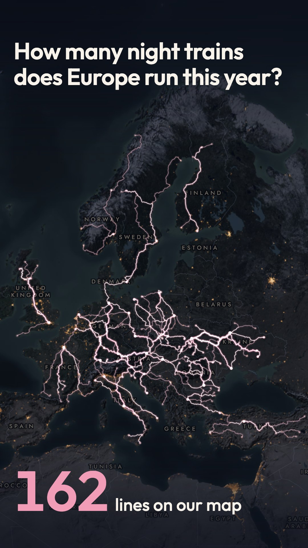
Over a night map of Europe, 162 night-train lines light up one after another, longest first and faster and faster, while a counter climbs to 162. After a held beat of near silence, every line dims except the Caledonian Sleeper, and the camera dives onto Britain as the Night map turns into the Live map. The real dawn of 7 Oct 2026 comes up over London and the Highlands, and the film ends on the daylit line with the invitation to draw your night train at trainmap.app.
- Map styles
- Night, Live
- Routes
- 162 European night-train lines (origin–destination pairs) in 2026, from Back-on-Track's Open Night Train Database: scheduled overnight passenger trains with sleeping and/or couchette cars, each pair counted once; Russia and Belarus excluded; Ukraine only where current service is verified (26 Ukrainian lines left out); Türkiye's 10 lines included; seasonal 2026 lines included. 155 drawn end to end, 7 with gaps where Trainmap's rail data has no track (Sicily pairs, the two Łeba pairs, Helsinki – Kolari); Hero line: London Euston – Fort William (Caledonian Sleeper, via Edinburgh, Crianlarich and Rannoch), the first line lit and the target of the dive
- On screen
- 0:00–0:04.8 How many night trains / does Europe run this year?
0:00.4–0:09.8 1 line on our map … 162 lines on our map
0:14.3–0:18.0 Draw your night train at / trainmap.app
throughout map labels from the Night style (country names)
- Captions
No caption drafted yet.
File · Cover · Metadata (JSON) · videos/night-trains/night-trains-map_1080x1920_18s.mp4
London to Edinburgh by train: one line that never cuts (map version)
video · 1080×1920 · 9:16 · 14.9 s · sound · 3.8 MB
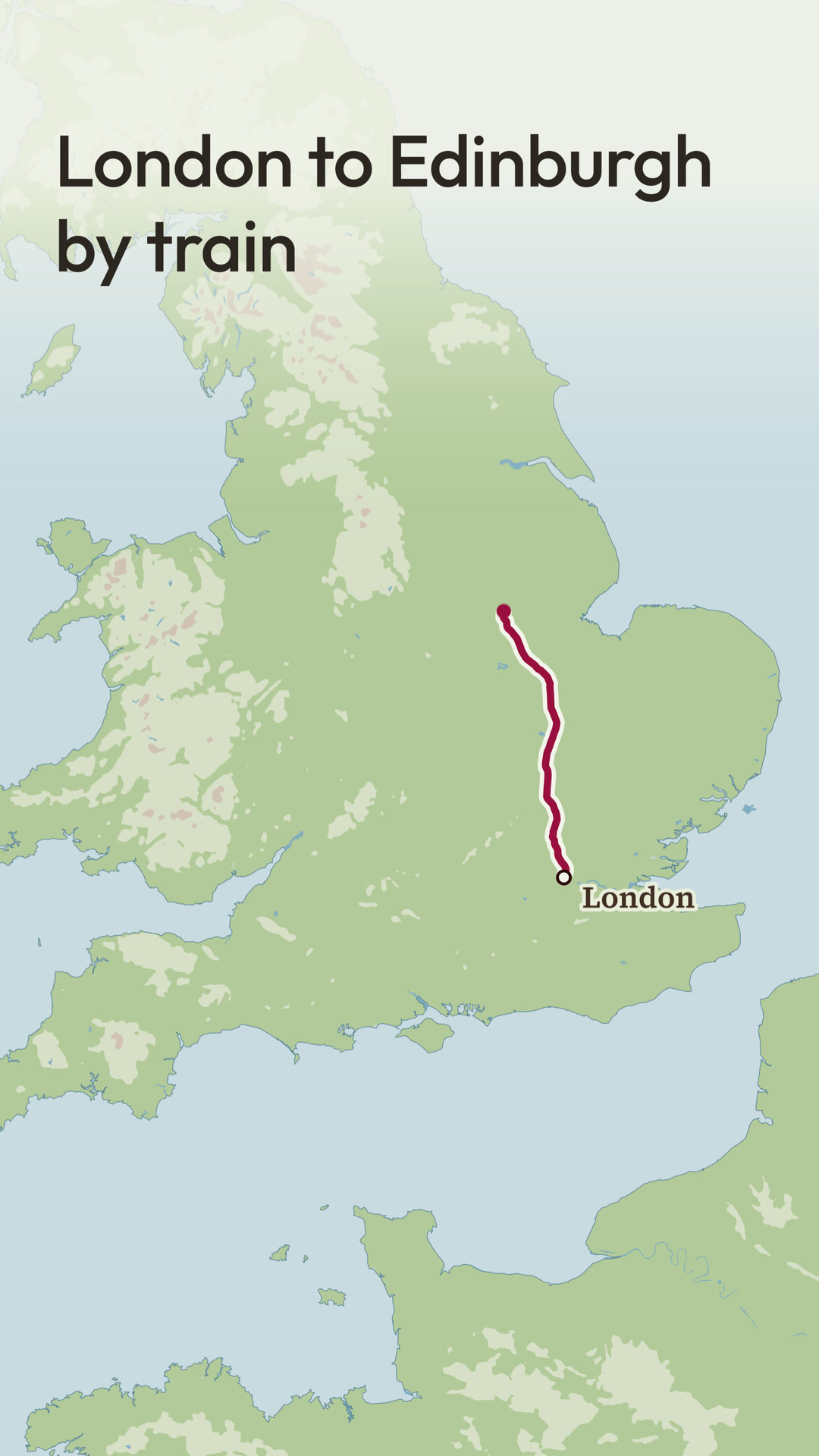
A claret dot over London opens like an iris onto the Atlas map, and the line draws north from London to Edinburgh on the real tracks as the camera follows, then rests at Edinburgh. The map drops out of the frame, and the line stays in the air and folds into the Trainmap ticket, which floods claret and is punched. The punched-out piece becomes the full stop of 'trainmap.app' under 'Draw a train trip, free'.
- Map styles
- Atlas
- Routes
- London Kings Cross to Edinburgh Waverley (East Coast Main Line), on Trainmap's baked track; no distance shown in this version
- On screen
- 0:00–~0:04.1 London to Edinburgh / by train
0:00–0:08.4 London, York, Newcastle, Edinburgh
~0:09–0:10.65 Trainmap
0:11.82–0:14.9 trainmap.app
0:12.05–0:14.9 Draw a train trip, free
- Captions
No caption drafted yet.
File · Cover · Metadata (JSON) · videos/one-line/one-line-map_1080x1920_15s.mp4
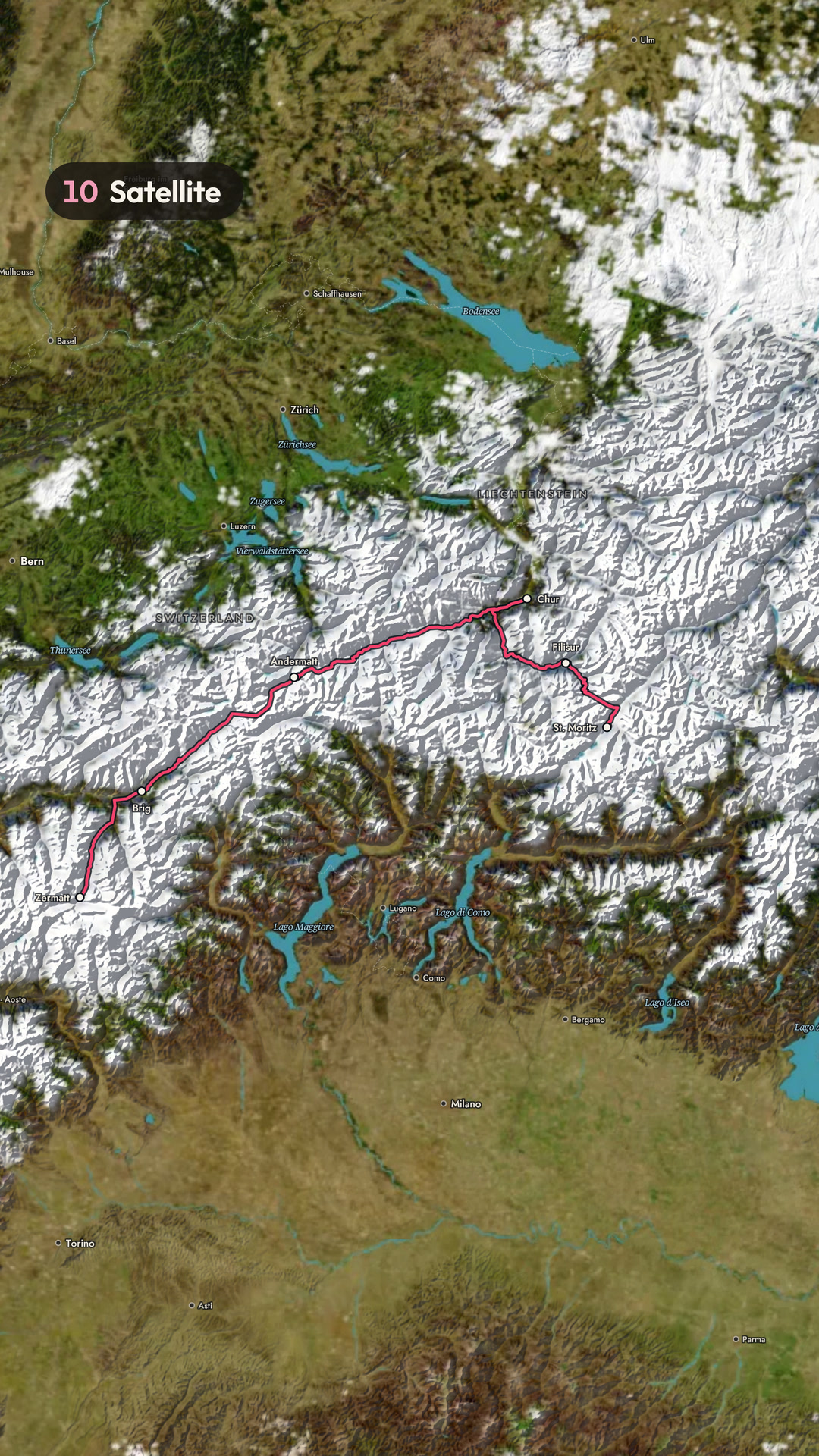
12 ways to map Zermatt → St. Moritz (map version)
video · 1080×1920 · 9:16 · 21 s · sound · 17 MB
The Glacier Express line from Zermatt to St. Moritz, on its real route page, is shown in all twelve Trainmap map styles. The styles cut on the beat at 120 BPM under one continuous camera, with a different reveal at each cut, and a numbered chip names each style. Live runs as a time-lapse of the real dusk on 20 Feb 2026, then the Trainmap ticket rises, is punched, and 'Draw yours at / trainmap.app' closes the film.
- Map styles
- Clean, Detailed, Dark, Relief, Atlas, Signal, LMS 1925, Sverige 1931, Rhein 1928, Satellite (February imagery, snow), Night, Live
- Routes
- Zermatt to St. Moritz (the Glacier Express line, via Brig, Andermatt, Chur and Filisur), from its route page; 291 km on Trainmap's route (not shown in this version)
- On screen
- 0:00–0:03.3 12 ways to map / Zermatt → St. Moritz
0:00 01 Clean
0:02.0 02 Detailed
0:03.5 03 Dark
0:04.5 04 Relief
0:05.5 05 Atlas
0:06.5 06 Signal
0:07.5 07 LMS 1925
0:08.0 08 Sverige 1931
0:08.5 09 Rhein 1928
0:09.5 10 Satellite
0:11.0 11 Night
0:12.5–0:15.0 Live 17:12 … Live 18:14
throughout map labels from each style (Zermatt, Brig, Andermatt, Chur, Filisur, St. Moritz, and others)
~0:15.2–0:16.0 Trainmap
0:16.25–0:21.0 Draw yours at / trainmap.app
- Captions
No caption drafted yet.
File · Cover · Metadata (JSON) · videos/styles-showcase/styles-2026-map_1080x1920_21s.mp4
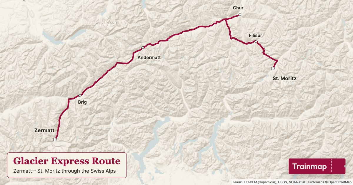
Glacier Express route map
image · 1200×630 · 1.91:1 · 0.1 MB
The Glacier Express line drawn in claret on trainmap.app's Clean map, stations marked, with a title panel ("Glacier Express Route", Zermatt → St. Moritz through the Swiss Alps) and the Trainmap ticket.
- Map styles
- Clean
- Routes
- Glacier Express
- On screen
- Glacier Express Route
Zermatt – St. Moritz through the Swiss Alps
Trainmap
- Alt text
- Map of the Glacier Express train route, Zermatt to St. Moritz
- Link
- https://trainmap.app/routes/glacier-express
- Captions
No caption drafted yet.
File · Metadata (JSON) · images/route-maps/glacier-express/glacier-express_map_clean_1200x630.jpg
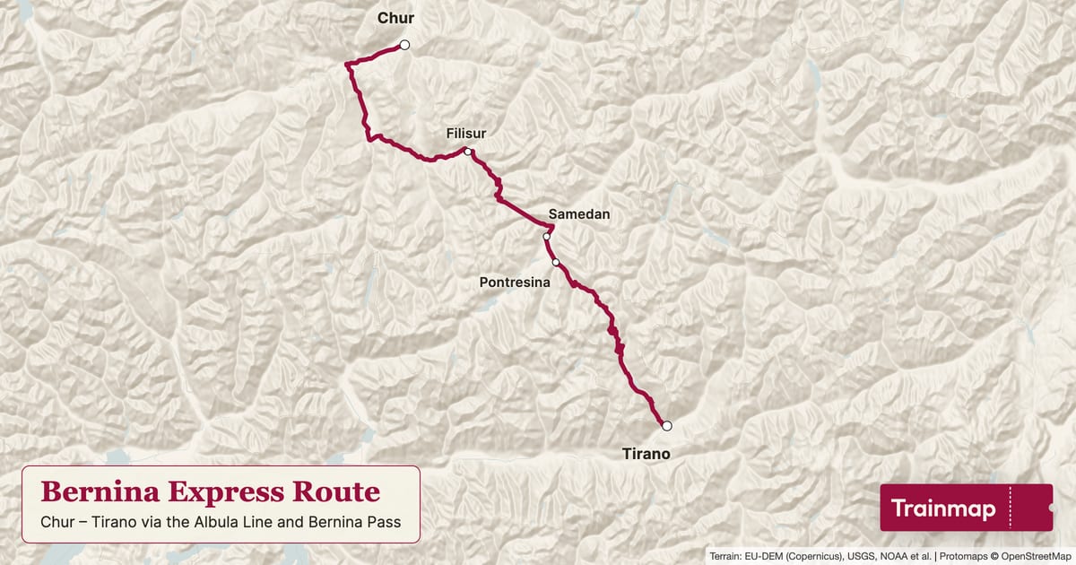
Bernina Express route map
image · 1200×630 · 1.91:1 · 0.1 MB
The Bernina Express line drawn in claret on trainmap.app's Clean map, stations marked, with a title panel ("Bernina Express Route", Chur → Tirano via the Albula Line and Bernina Pass) and the Trainmap ticket.
- Map styles
- Clean
- Routes
- Bernina Express
- On screen
- Bernina Express Route
Chur – Tirano via the Albula Line and Bernina Pass
Trainmap
- Alt text
- Map of the Bernina Express train route, Chur to Tirano RhB
- Link
- https://trainmap.app/routes/bernina-express
- Captions
No caption drafted yet.
File · Metadata (JSON) · images/route-maps/bernina-express/bernina-express_map_clean_1200x630.jpg
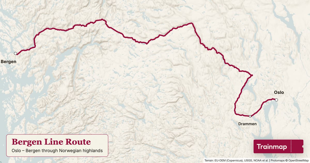
Bergen Line route map
image · 1200×630 · 1.91:1 · 0.1 MB
The Bergen Line line drawn in claret on trainmap.app's Clean map, stations marked, with a title panel ("Bergen Line Route", Oslo → Bergen through Norwegian highlands) and the Trainmap ticket.
- Map styles
- Clean
- Routes
- Bergen Line
- On screen
- Bergen Line Route
Oslo – Bergen through Norwegian highlands
Trainmap
- Alt text
- Map of the Bergen Line train route, Oslo S to Bergen stasjon
- Link
- https://trainmap.app/routes/bergen-line
- Captions
No caption drafted yet.
File · Metadata (JSON) · images/route-maps/bergen-line/bergen-line_map_clean_1200x630.jpg
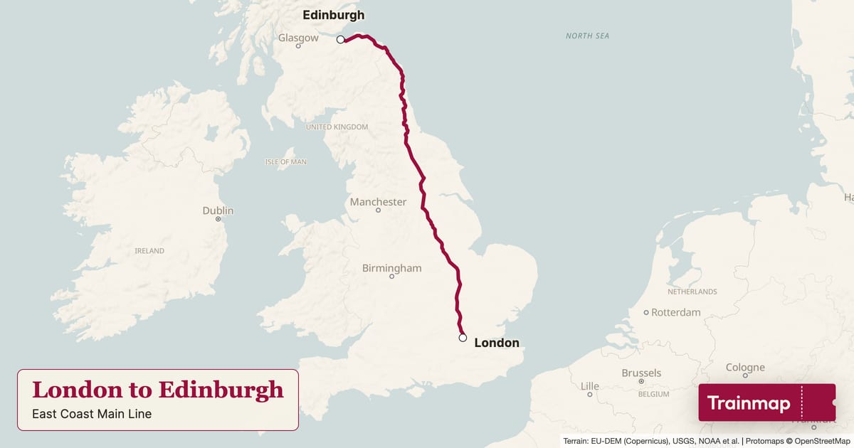
London to Edinburgh route map
image · 1200×630 · 1.91:1 · 0 MB
The London to Edinburgh line drawn in claret on trainmap.app's Clean map, stations marked, with a title panel ("London to Edinburgh Route", East Coast Main Line) and the Trainmap ticket.
- Map styles
- Clean
- Routes
- London to Edinburgh
- On screen
- London to Edinburgh Route
East Coast Main Line
Trainmap
- Alt text
- Map of the London to Edinburgh train route, London Kings Cross to Edinburgh Waverley
- Link
- https://trainmap.app/routes/london-to-edinburgh
- Captions
No caption drafted yet.
File · Metadata (JSON) · images/route-maps/london-to-edinburgh/london-to-edinburgh_map_clean_1200x630.jpg
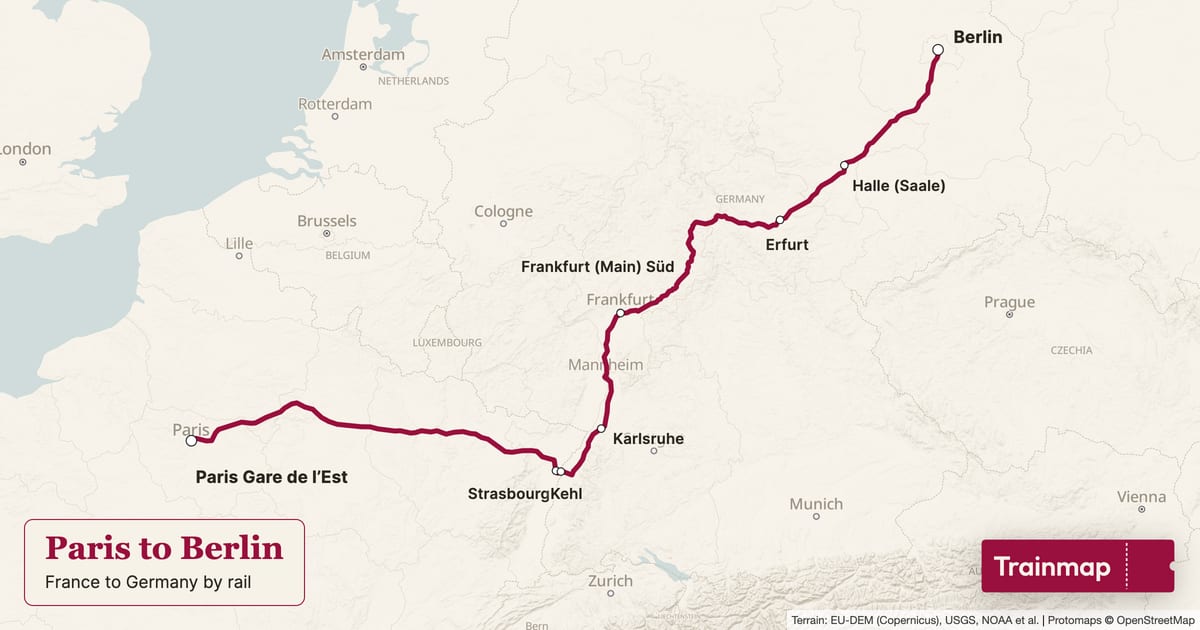
Paris to Berlin route map
image · 1200×630 · 1.91:1 · 0.1 MB
The Paris to Berlin line drawn in claret on trainmap.app's Clean map, stations marked, with a title panel ("Paris to Berlin Route", France to Germany by rail) and the Trainmap ticket.
- Map styles
- Clean
- Routes
- Paris to Berlin
- On screen
- Paris to Berlin Route
France to Germany by rail
Trainmap
- Alt text
- Map of the Paris to Berlin train route, Paris Gare de l’Est to Berlin Hbf
- Link
- https://trainmap.app/routes/paris-to-berlin
- Captions
No caption drafted yet.
File · Metadata (JSON) · images/route-maps/paris-to-berlin/paris-to-berlin_map_clean_1200x630.jpg
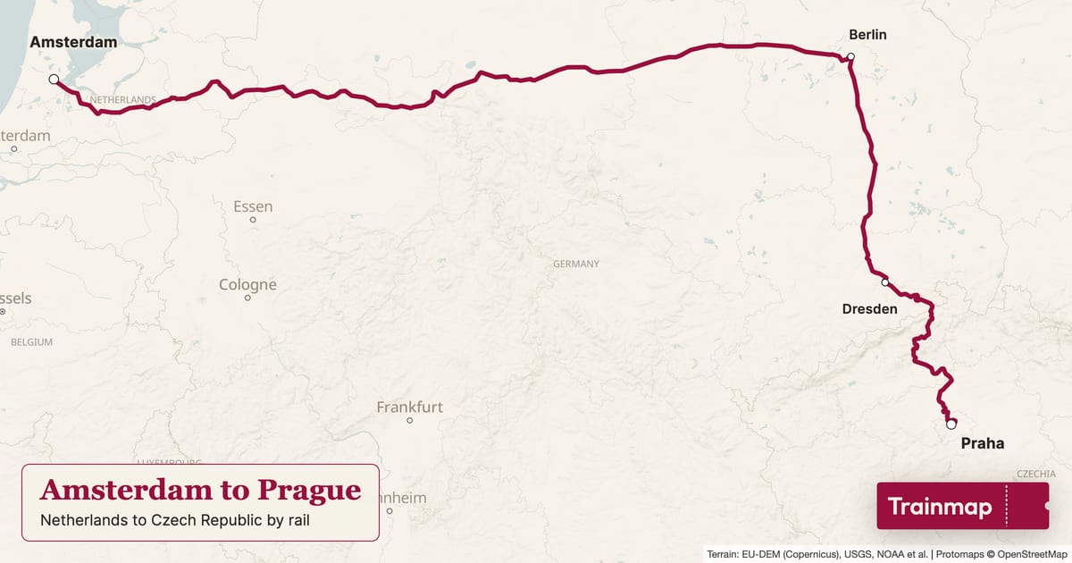
Amsterdam to Prague route map
image · 1200×630 · 1.91:1 · 0.1 MB
The Amsterdam to Prague line drawn in claret on trainmap.app's Clean map, stations marked, with a title panel ("Amsterdam to Prague Route", Netherlands to Czech Republic by rail) and the Trainmap ticket.
- Map styles
- Clean
- Routes
- Amsterdam to Prague
- On screen
- Amsterdam to Prague Route
Netherlands to Czech Republic by rail
Trainmap
- Alt text
- Map of the Amsterdam to Prague train route, Amsterdam to Praha hl.n.
- Link
- https://trainmap.app/routes/amsterdam-to-prague
- Captions
No caption drafted yet.
File · Metadata (JSON) · images/route-maps/amsterdam-to-prague/amsterdam-to-prague_map_clean_1200x630.jpg
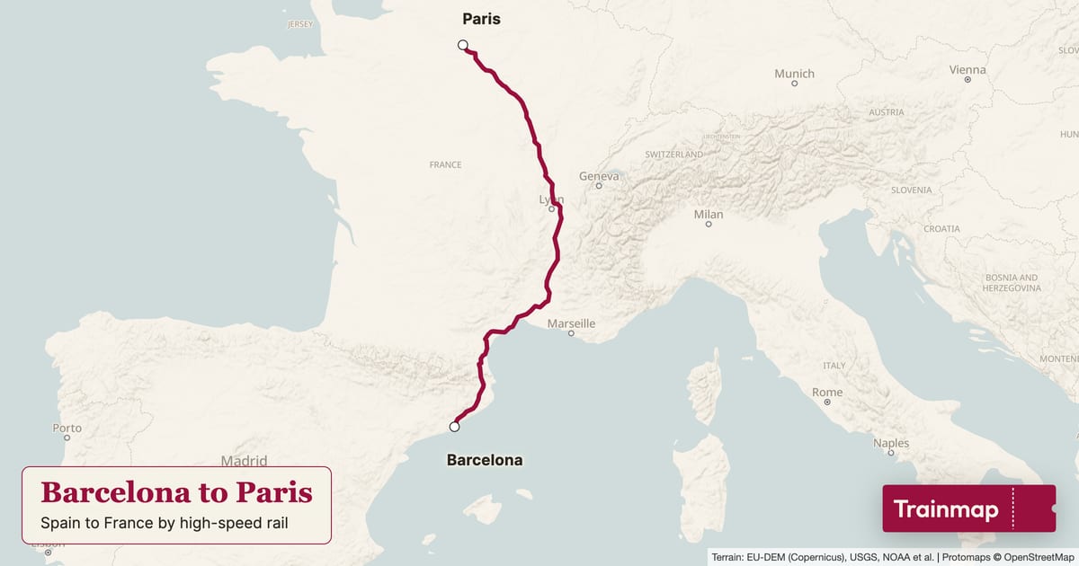
Barcelona to Paris route map
image · 1200×630 · 1.91:1 · 0.1 MB
The Barcelona to Paris line drawn in claret on trainmap.app's Clean map, stations marked, with a title panel ("Barcelona to Paris Route", Spain to France by high-speed rail) and the Trainmap ticket.
- Map styles
- Clean
- Routes
- Barcelona to Paris
- On screen
- Barcelona to Paris Route
Spain to France by high-speed rail
Trainmap
- Alt text
- Map of the Barcelona to Paris train route, Barcelona Sants to Paris Gare de Lyon
- Link
- https://trainmap.app/routes/barcelona-to-paris
- Captions
No caption drafted yet.
File · Metadata (JSON) · images/route-maps/barcelona-to-paris/barcelona-to-paris_map_clean_1200x630.jpg
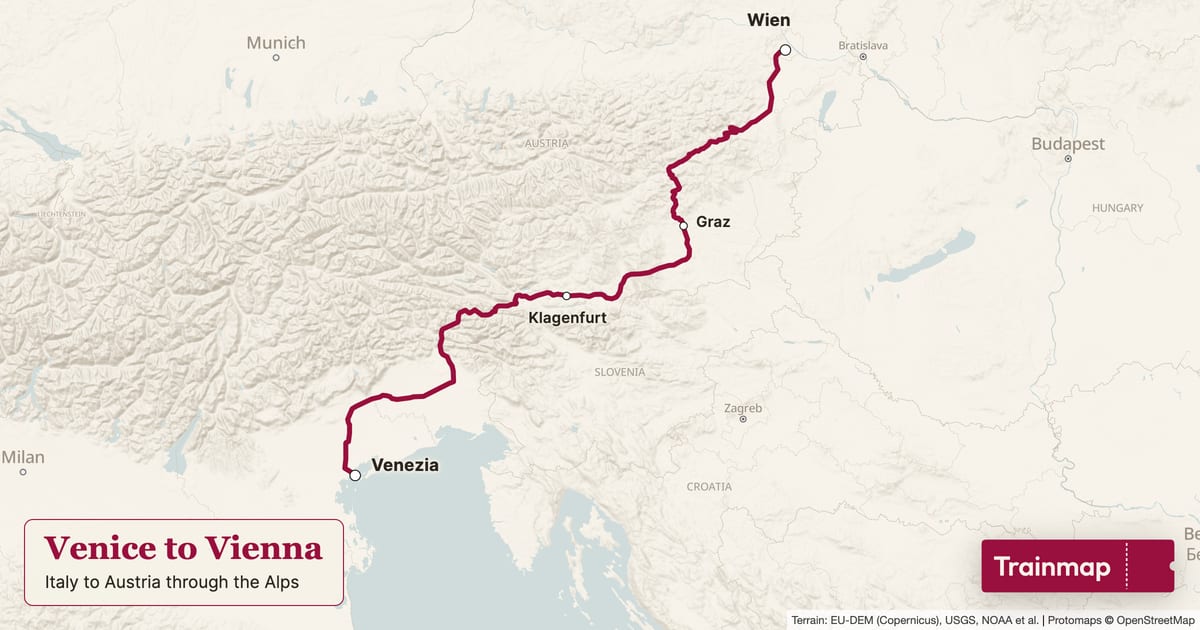
Venice to Vienna route map
image · 1200×630 · 1.91:1 · 0.1 MB
The Venice to Vienna line drawn in claret on trainmap.app's Clean map, stations marked, with a title panel ("Venice to Vienna Route", Italy to Austria through the Alps) and the Trainmap ticket.
- Map styles
- Clean
- Routes
- Venice to Vienna
- On screen
- Venice to Vienna Route
Italy to Austria through the Alps
Trainmap
- Alt text
- Map of the Venice to Vienna train route, Venezia Santa Lucia to Wien Hbf
- Link
- https://trainmap.app/routes/venice-to-vienna
- Captions
No caption drafted yet.
File · Metadata (JSON) · images/route-maps/venice-to-vienna/venice-to-vienna_map_clean_1200x630.jpg
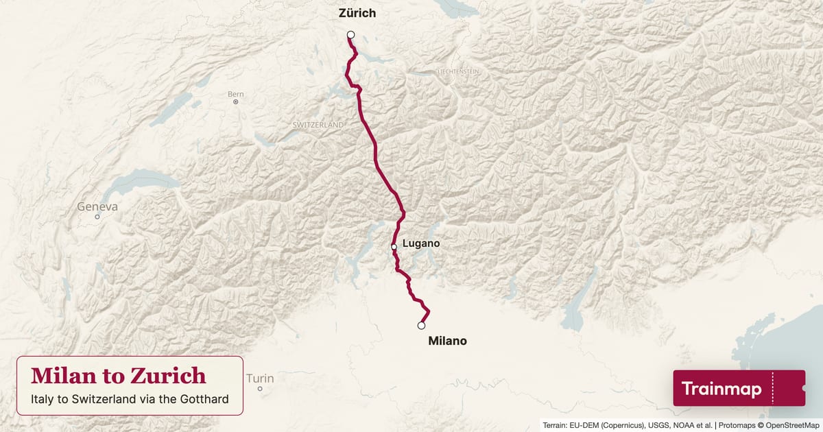
Milan to Zurich route map
image · 1200×630 · 1.91:1 · 0.1 MB
The Milan to Zurich line drawn in claret on trainmap.app's Clean map, stations marked, with a title panel ("Milan to Zurich Route", Italy to Switzerland via the Gotthard) and the Trainmap ticket.
- Map styles
- Clean
- Routes
- Milan to Zurich
- On screen
- Milan to Zurich Route
Italy to Switzerland via the Gotthard
Trainmap
- Alt text
- Map of the Milan to Zurich train route, Milano Centrale to Zürich HB
- Link
- https://trainmap.app/routes/milan-to-zurich
- Captions
No caption drafted yet.
File · Metadata (JSON) · images/route-maps/milan-to-zurich/milan-to-zurich_map_clean_1200x630.jpg
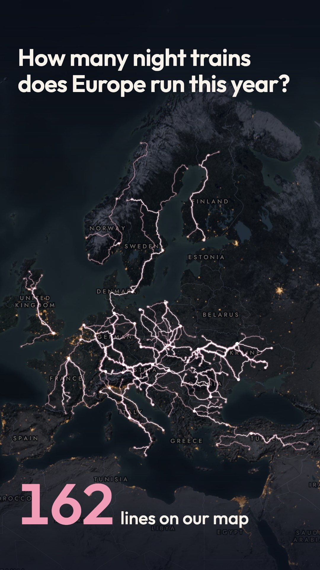
How many night trains does Europe run this year? (poster version)
video · 1080×1920 · 9:16 · 17.5 s · sound · 10.2 MB
Over a night map of Europe, 162 night-train lines light up one after another, longest first and faster and faster, while a counter climbs to 162. After a held beat of near silence, the whole lit network settles into a 50 × 70 poster in the Night poster theme, and its glow cools from light to ink as it prints. The poster reads 'Europe by night train / 162 lines', and the film ends on the invitation to draw your night trains on a poster at trainmap.app.
- Map styles
- Night
- Routes
- 162 European night-train lines (origin–destination pairs) in 2026, from Back-on-Track's Open Night Train Database: scheduled overnight passenger trains with sleeping and/or couchette cars, each pair counted once; Russia and Belarus excluded; Ukraine only where current service is verified (26 Ukrainian lines left out); Türkiye's 10 lines included; seasonal 2026 lines included. 155 drawn end to end, 7 with gaps where Trainmap's rail data has no track
- On screen
- 0:00–0:04.8 How many night trains / does Europe run this year?
0:00.4–~0:09 1 line on our map … 162 lines on our map
0:11.1 Europe by night train / 162 lines
0:11.1 © OpenStreetMap contributors · trainmap.app
0:12.6–0:17.5 Draw your night trains on a poster / trainmap.app
- Captions
No caption drafted yet.
File · Cover · Metadata (JSON) · videos/night-trains/night-trains-poster_1080x1920_18s.mp4
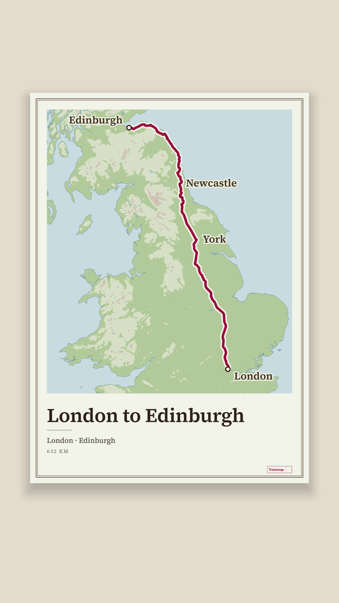
London to Edinburgh by train: one line that never cuts (poster version)
video · 1080×1920 · 9:16 · 21.7 s · sound · 6.7 MB
A claret dot over London opens onto the Atlas map, and the line draws north to Edinburgh on the real tracks. The pen then runs round the poster's map window and cuts it out, and the cut line swells into the edge of a 50 × 70 sheet on the wall, where the poster's lettering sets. The sheet drops away and the line folds into the Trainmap ticket, which is punched, and the punched-out piece becomes the full stop of 'trainmap.app' under 'Draw a train trip, free'.
- Map styles
- Atlas
- Routes
- London Kings Cross to Edinburgh Waverley (East Coast Main Line), on Trainmap's baked track; 632 km as printed on the poster
- On screen
- 0:00–~0:04.1 London to Edinburgh / by train
0:00–0:08.4 London, York, Newcastle, Edinburgh
0:10.95–0:14.85 London to Edinburgh / London · Edinburgh / 632 KM
~0:16.2–0:17.8 Trainmap
0:18.62–0:21.7 trainmap.app
0:18.85–0:21.7 Draw a train trip, free
- Captions
No caption drafted yet.
File · Cover · Metadata (JSON) · videos/one-line/one-line-poster_1080x1920_22s.mp4
Every train you took this year (poster version)
video · 1080×1920 · 9:16 · 21.5 s · no sound · 11.1 MB
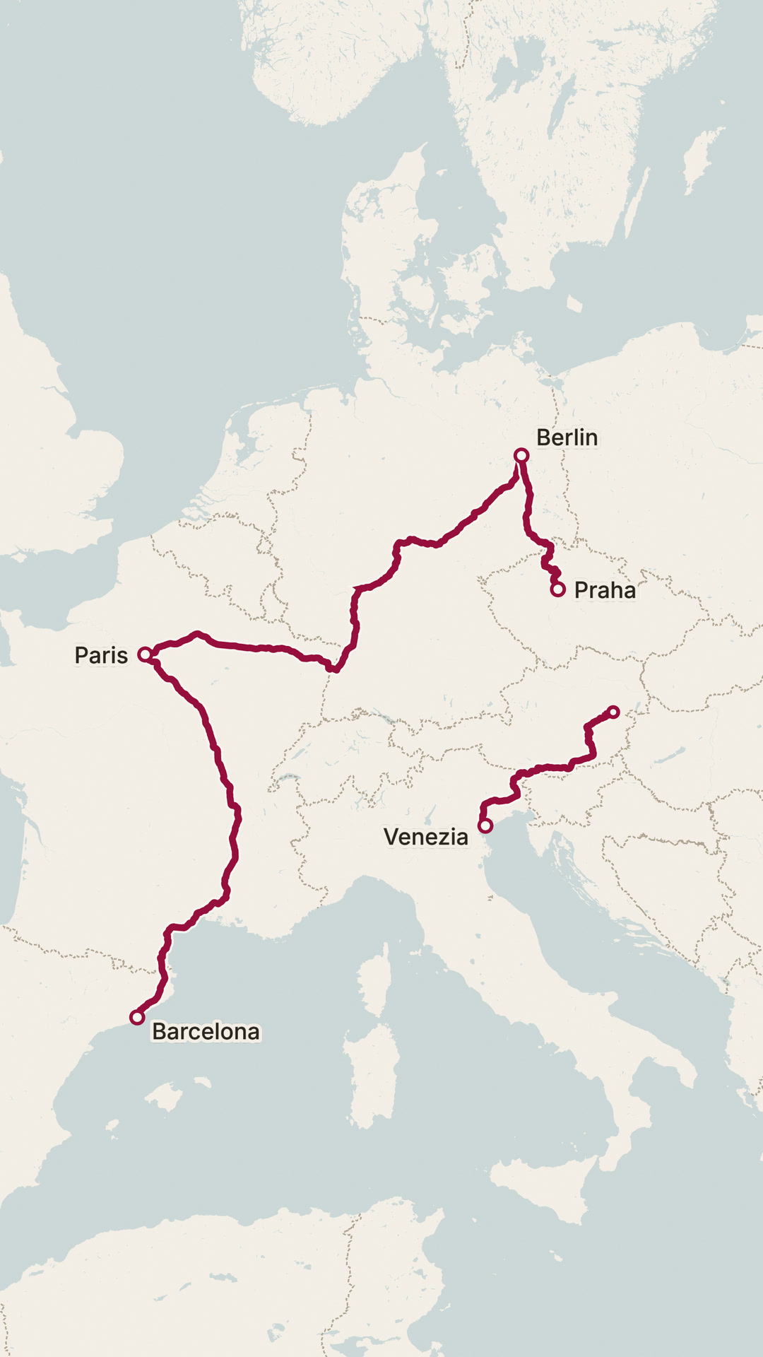
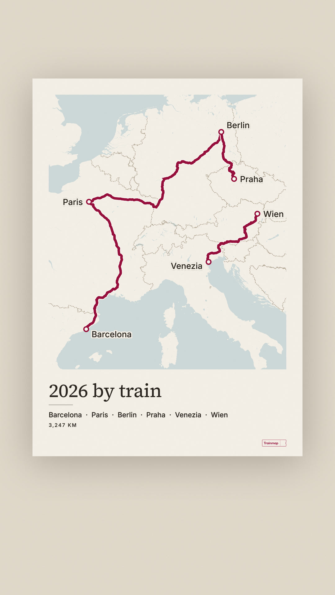
A claret line draws four real 2026 train trips on Trainmap's track: Barcelona → Paris → Berlin → Praha, then Venezia → Wien. The frame then closes in around them and a 50 × 70 poster grows round the map on the wall, with the lettering '2026 by train'. The poster's signature ticket grows into a claret ticket that is punched, and the chad drops out of frame, before 'Draw yours at / trainmap.app'.
- Map styles
- Clean
- Routes
- Barcelona → Paris (1,078 km on our map); Paris → Berlin (1,166 km); Berlin → Praha (378 km, cut from Amsterdam–Prague at Berlin Hbf); Venezia → Wien (625 km); Total printed on the poster: 3,247 KM
- On screen
- 0:00–~0:05.1 Every train you took / this year
0:00–0:09.65 Barcelona, Paris, Berlin, Praha, Venezia, Wien
0:12.2–~0:16 2026 by train / Barcelona · Paris · Berlin · Praha · Venezia · Wien / 3,247 KM
0:16–0:17.6 Trainmap
0:17.95–0:21.5 Draw yours at / trainmap.app
- Captions
No caption drafted yet.
File · Cover · Metadata (JSON) · videos/promo/promo-2026-poster_1080x1920_22s.mp4
12 ways to map Zermatt → St. Moritz (poster version)
video · 1080×1920 · 9:16 · 21 s · sound · 18.7 MB
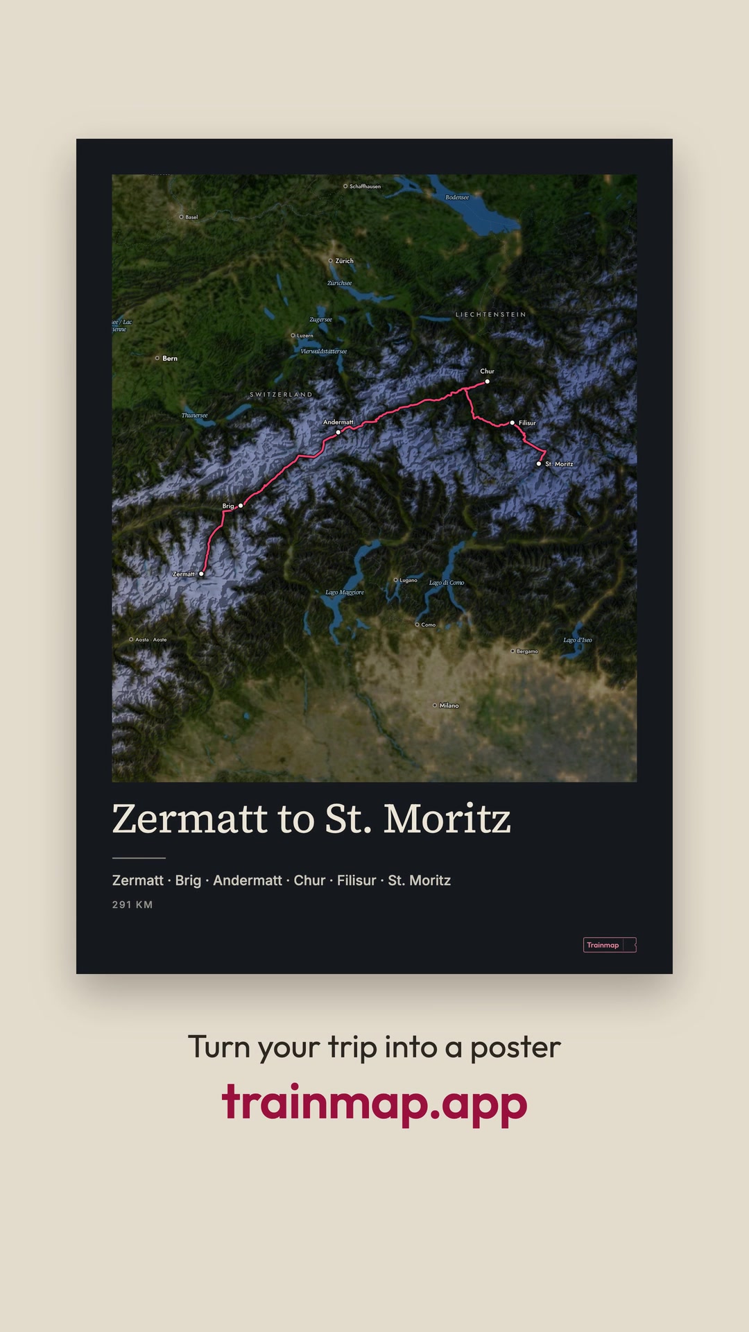
The Glacier Express line from Zermatt to St. Moritz is shown in all twelve Trainmap map styles, cut on the beat at 120 BPM, with a numbered chip naming each style and Live as a time-lapse of the real dusk on 20 Feb 2026. After Live, the map settles into a 50 × 70 poster on the wall in the editor's Gallery layout (dark theme) and the poster's lettering sets. The film ends on 'Turn your trip into a poster / trainmap.app'.
- Map styles
- Clean, Detailed, Dark, Relief, Atlas, Signal, LMS 1925, Sverige 1931, Rhein 1928, Satellite (February imagery, snow), Night, Live
- Routes
- Zermatt to St. Moritz (the Glacier Express line, via Brig, Andermatt, Chur and Filisur), from its route page; 291 km as printed on the poster
- On screen
- 0:00–0:03.3 12 ways to map / Zermatt → St. Moritz
0:00–0:12.5 01 Clean, 02 Detailed (2.0 s), 03 Dark (3.5), 04 Relief (4.5), 05 Atlas (5.5), 06 Signal (6.5), 07 LMS 1925 (7.5), 08 Sverige 1931 (8.0), 09 Rhein 1928 (8.5), 10 Satellite (9.5), 11 Night (11.0)
0:12.5–0:15.0 Live 17:12 … Live 18:14
throughout map labels from each style
~0:16.5 Zermatt to St. Moritz / Zermatt · Brig · Andermatt · Chur · Filisur · St. Moritz / 291 KM
~0:16.8 Trainmap
~0:17.5–0:21.0 Turn your trip into a poster / trainmap.app
- Captions
No caption drafted yet.
File · Cover · Metadata (JSON) · videos/styles-showcase/styles-2026-poster_1080x1920_21s.mp4
Glacier Express poster
image · 960×1345 · 5:7 · 0.2 MB
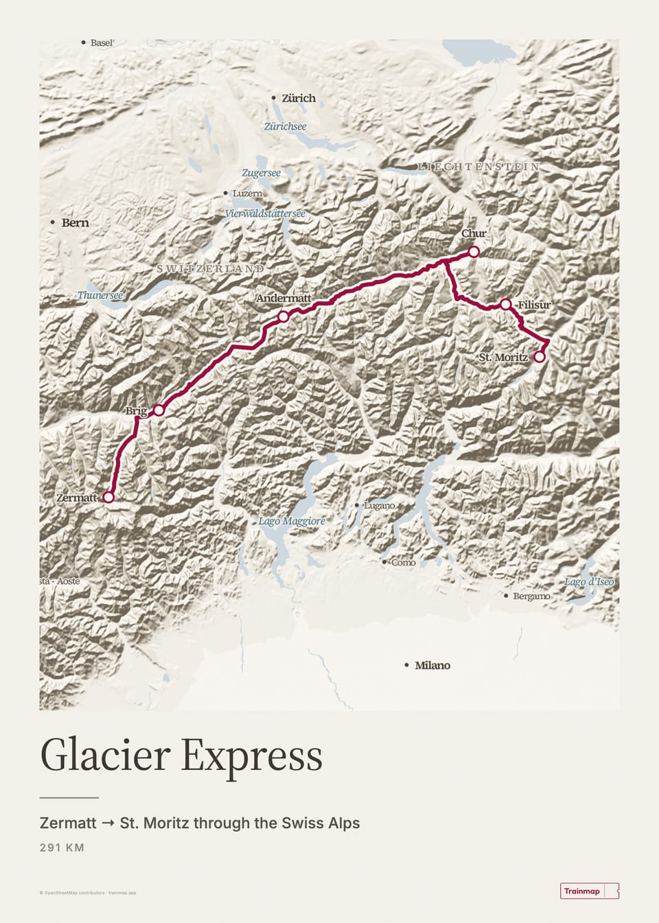
The Glacier Express as a 50 × 70 cm poster on the Relief map: the line in claret, the title "Glacier Express", "Zermatt → St. Moritz through the Swiss Alps" and the distance.
- Map styles
- Relief
- Routes
- Glacier Express
- On screen
- Glacier Express
Zermatt → St. Moritz through the Swiss Alps
291 km
- Alt text
- Poster of the Glacier Express on the Relief map
- Link
- https://trainmap.app/routes/glacier-express
- Captions
No caption drafted yet.
File · Metadata (JSON) · images/route-posters/glacier-express/glacier-express_poster_relief_960x1345.jpg
Bernina Express poster
image · 960×1345 · 5:7 · 0.1 MB
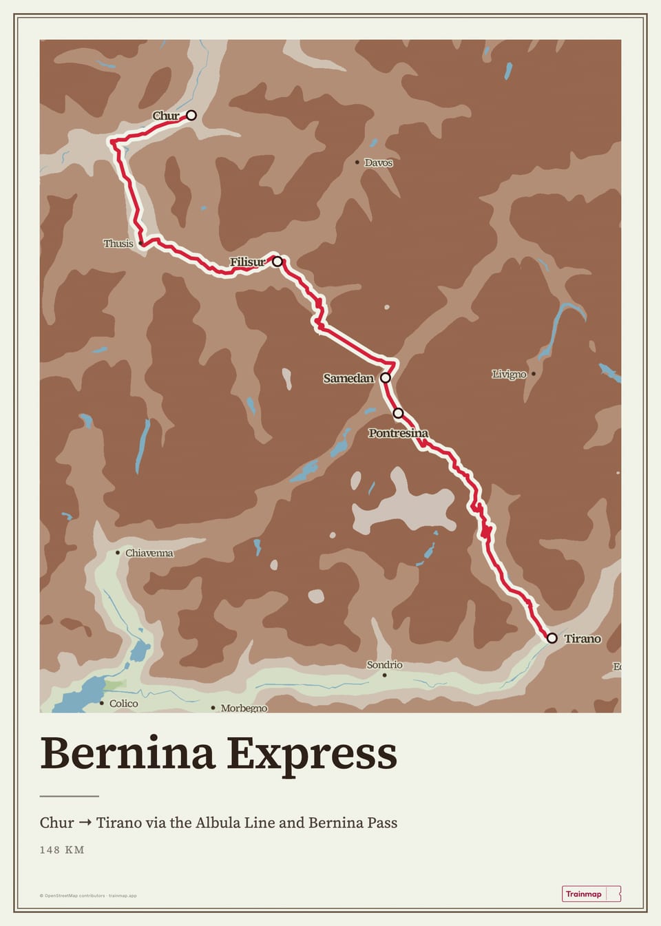
The Bernina Express as a 50 × 70 cm poster on the Atlas map: the line in claret, the title "Bernina Express", "Chur → Tirano via the Albula Line and Bernina Pass" and the distance.
- Map styles
- Atlas
- Routes
- Bernina Express
- On screen
- Bernina Express
Chur → Tirano via the Albula Line and Bernina Pass
148 km
- Alt text
- Poster of the Bernina Express on the Atlas map
- Link
- https://trainmap.app/routes/bernina-express
- Captions
No caption drafted yet.
File · Metadata (JSON) · images/route-posters/bernina-express/bernina-express_poster_atlas_960x1345.jpg
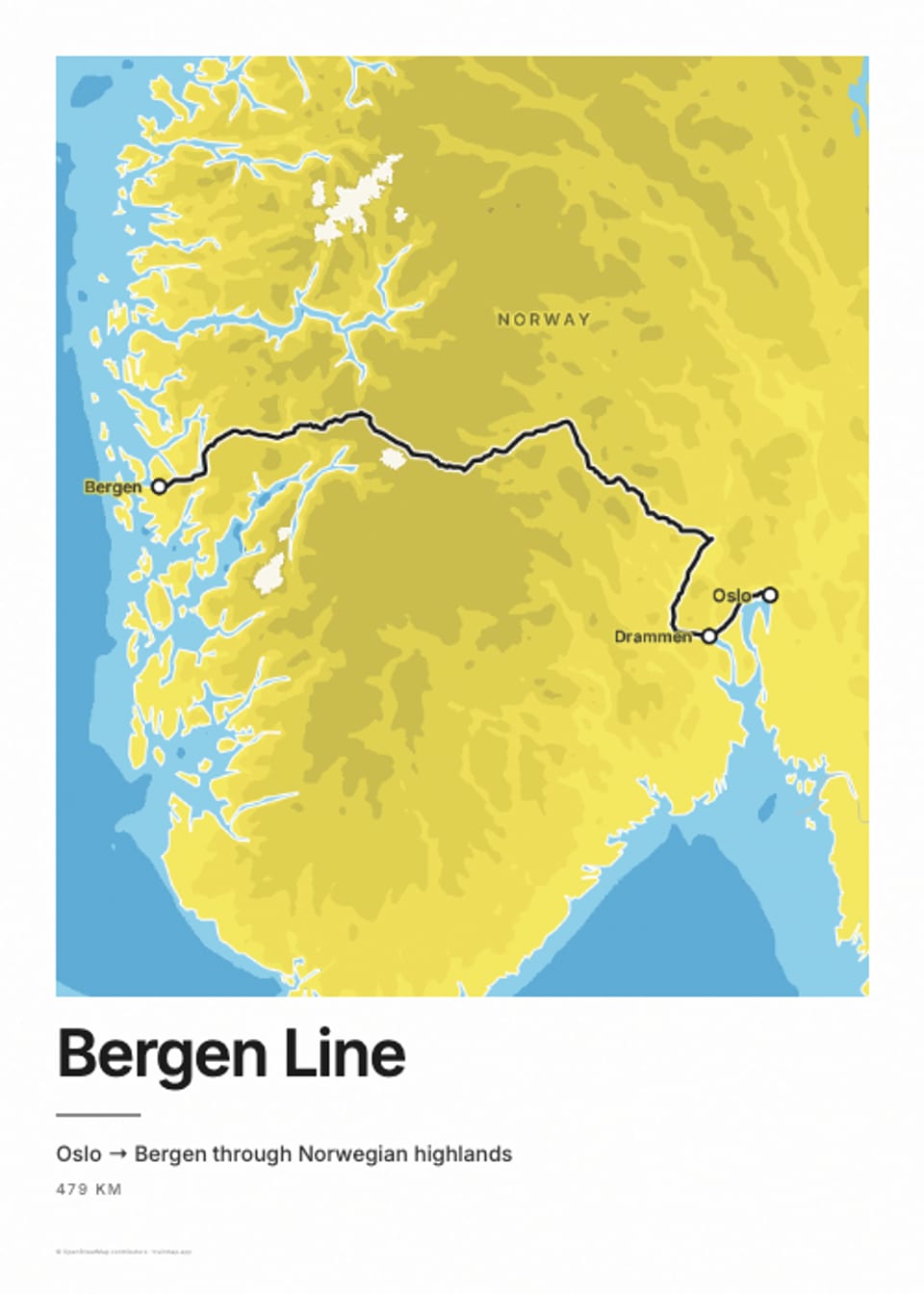
Bergen Line poster
image · 960×1344 · 5:7 · 0.1 MB
The Bergen Line as a 50 × 70 cm poster on the Signal map: the line in claret, the title "Bergen Line", "Oslo → Bergen through Norwegian highlands" and the distance.
- Map styles
- Signal
- Routes
- Bergen Line
- On screen
- Bergen Line
Oslo → Bergen through Norwegian highlands
479 km
- Alt text
- Poster of the Bergen Line on the Signal map
- Link
- https://trainmap.app/routes/bergen-line
- Captions
No caption drafted yet.
File · Metadata (JSON) · images/route-posters/bergen-line/bergen-line_poster_signal_960x1344.jpg
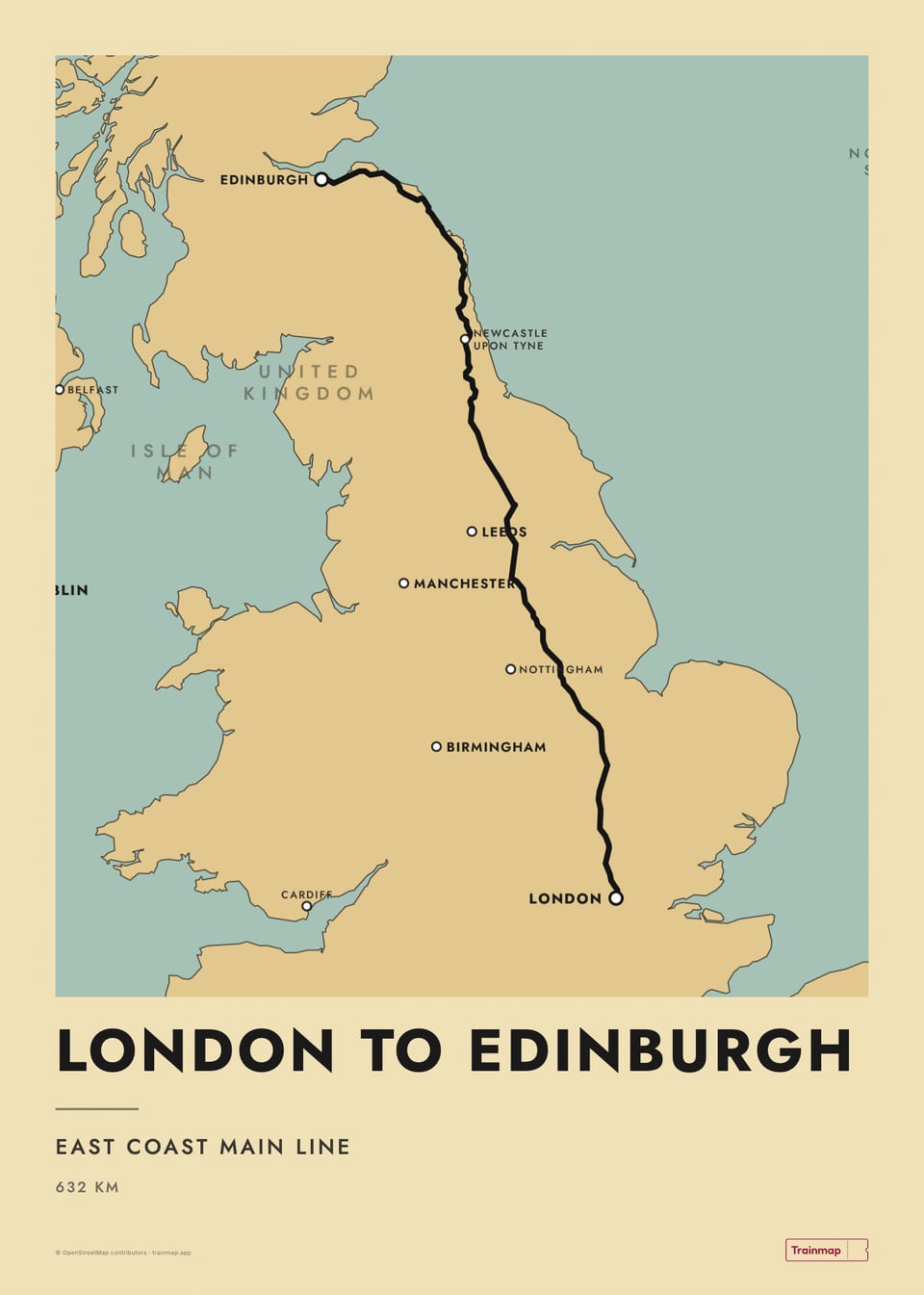
London to Edinburgh poster
image · 960×1345 · 5:7 · 0.1 MB
The London to Edinburgh as a 50 × 70 cm poster on the LMS 1925 map: the line in claret, the title "London to Edinburgh", "East Coast Main Line" and the distance.
- Map styles
- LMS 1925
- Routes
- London to Edinburgh
- On screen
- London to Edinburgh
East Coast Main Line
632 km
- Alt text
- Poster of the London to Edinburgh on the LMS 1925 map
- Link
- https://trainmap.app/routes/london-to-edinburgh
- Captions
No caption drafted yet.
File · Metadata (JSON) · images/route-posters/london-to-edinburgh/london-to-edinburgh_poster_lms-1925_960x1345.jpg
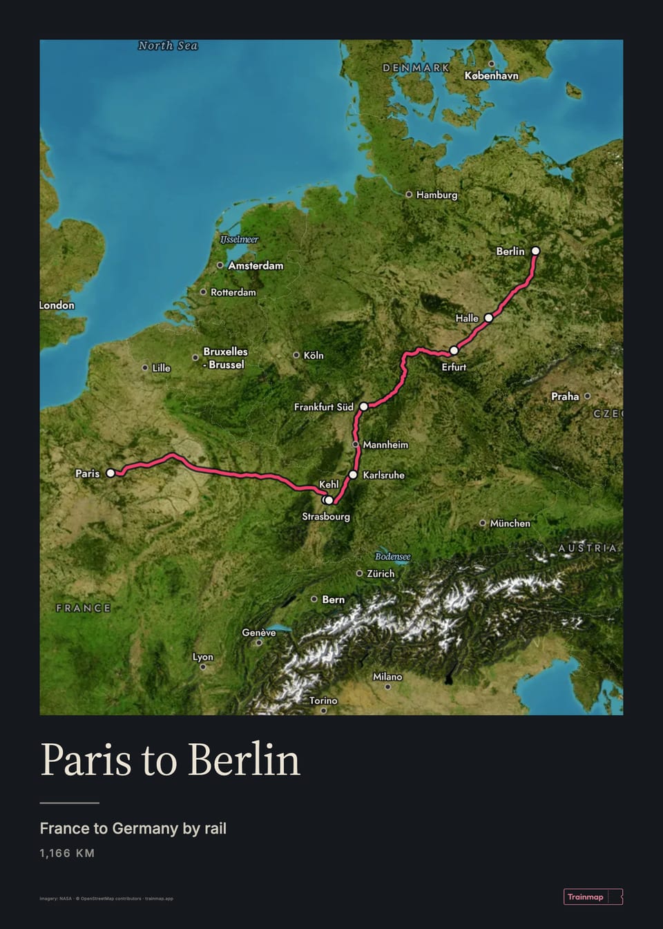
Paris to Berlin poster
image · 960×1345 · 5:7 · 0.2 MB
The Paris to Berlin as a 50 × 70 cm poster on the Satellite map: the line in claret, the title "Paris to Berlin", "France to Germany by rail" and the distance.
- Map styles
- Satellite
- Routes
- Paris to Berlin
- On screen
- Paris to Berlin
France to Germany by rail
1,166 km
- Alt text
- Poster of the Paris to Berlin on the Satellite map
- Link
- https://trainmap.app/routes/paris-to-berlin
- Captions
No caption drafted yet.
File · Metadata (JSON) · images/route-posters/paris-to-berlin/paris-to-berlin_poster_satellite_960x1345.jpg
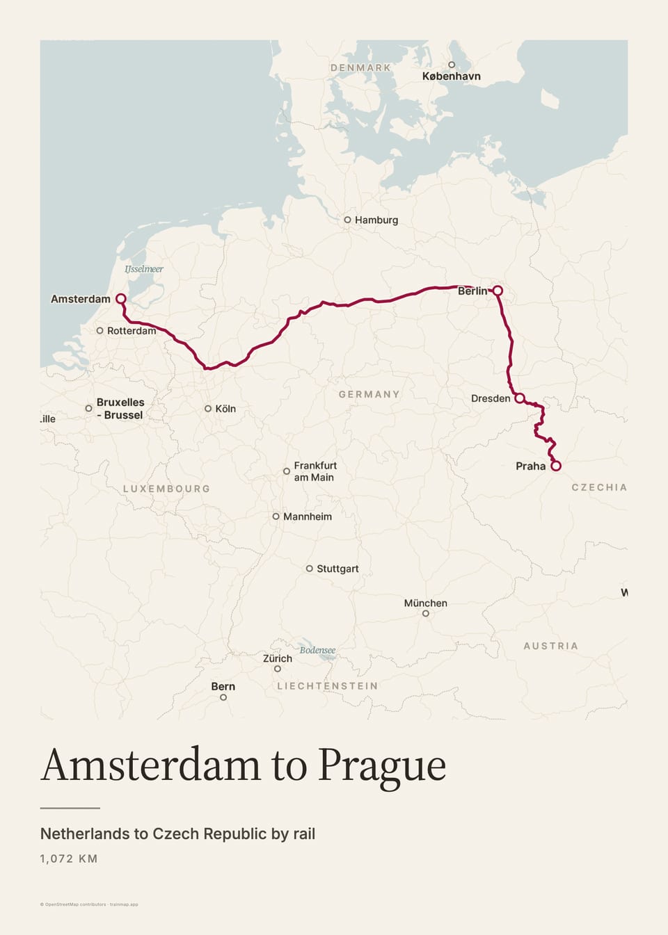
Amsterdam to Prague poster
image · 960×1345 · 5:7 · 0.1 MB
The Amsterdam to Prague as a 50 × 70 cm poster on the Detailed map: the line in claret, the title "Amsterdam to Prague", "Netherlands to Czech Republic by rail" and the distance.
- Map styles
- Detailed
- Routes
- Amsterdam to Prague
- On screen
- Amsterdam to Prague
Netherlands to Czech Republic by rail
1,017 km
- Alt text
- Poster of the Amsterdam to Prague on the Detailed map
- Link
- https://trainmap.app/routes/amsterdam-to-prague
- Captions
No caption drafted yet.
File · Metadata (JSON) · images/route-posters/amsterdam-to-prague/amsterdam-to-prague_poster_detailed_960x1345.jpg
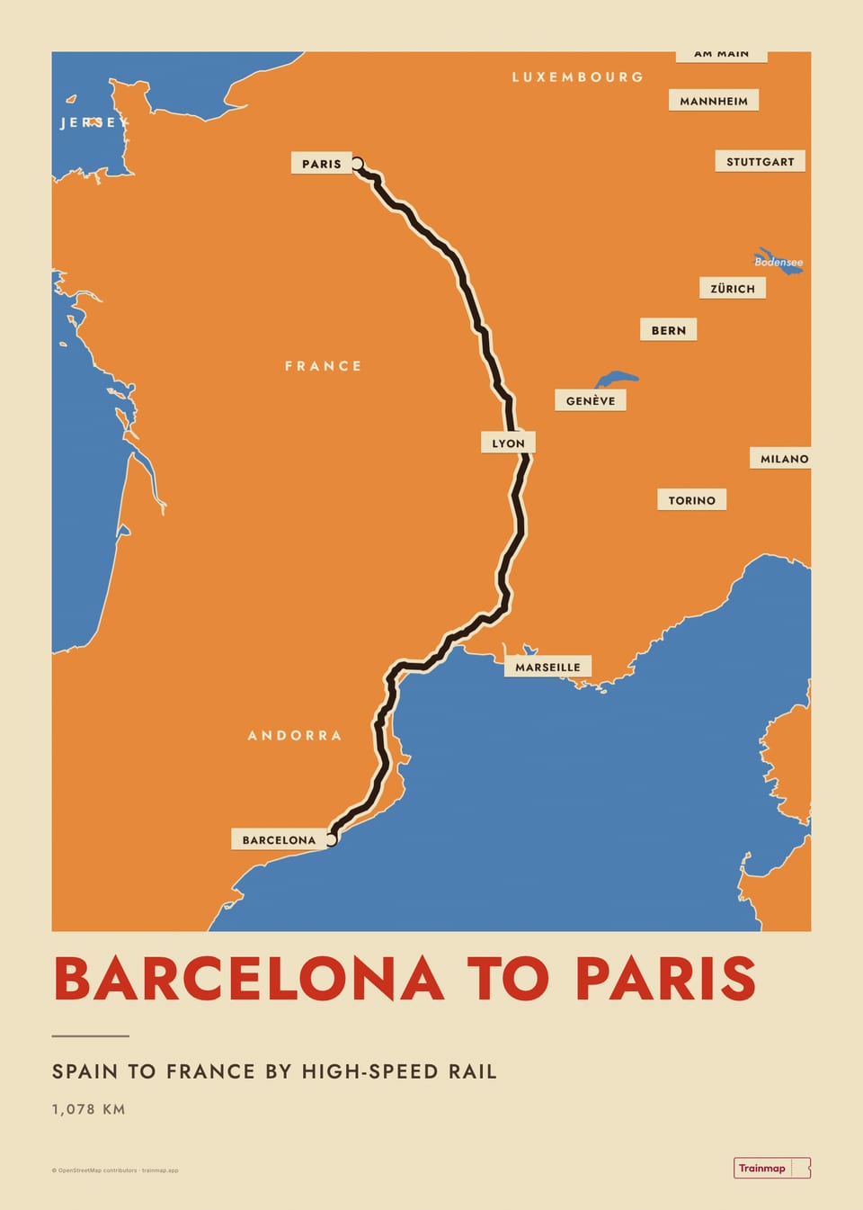
Barcelona to Paris poster
image · 960×1345 · 5:7 · 0.1 MB
The Barcelona to Paris as a 50 × 70 cm poster on the Sverige 1931 map: the line in claret, the title "Barcelona to Paris", "Spain to France by high-speed rail" and the distance.
- Map styles
- Sverige 1931
- Routes
- Barcelona to Paris
- On screen
- Barcelona to Paris
Spain to France by high-speed rail
1,078 km
- Alt text
- Poster of the Barcelona to Paris on the Sverige 1931 map
- Link
- https://trainmap.app/routes/barcelona-to-paris
- Captions
No caption drafted yet.
File · Metadata (JSON) · images/route-posters/barcelona-to-paris/barcelona-to-paris_poster_sverige-1931_960x1345.jpg
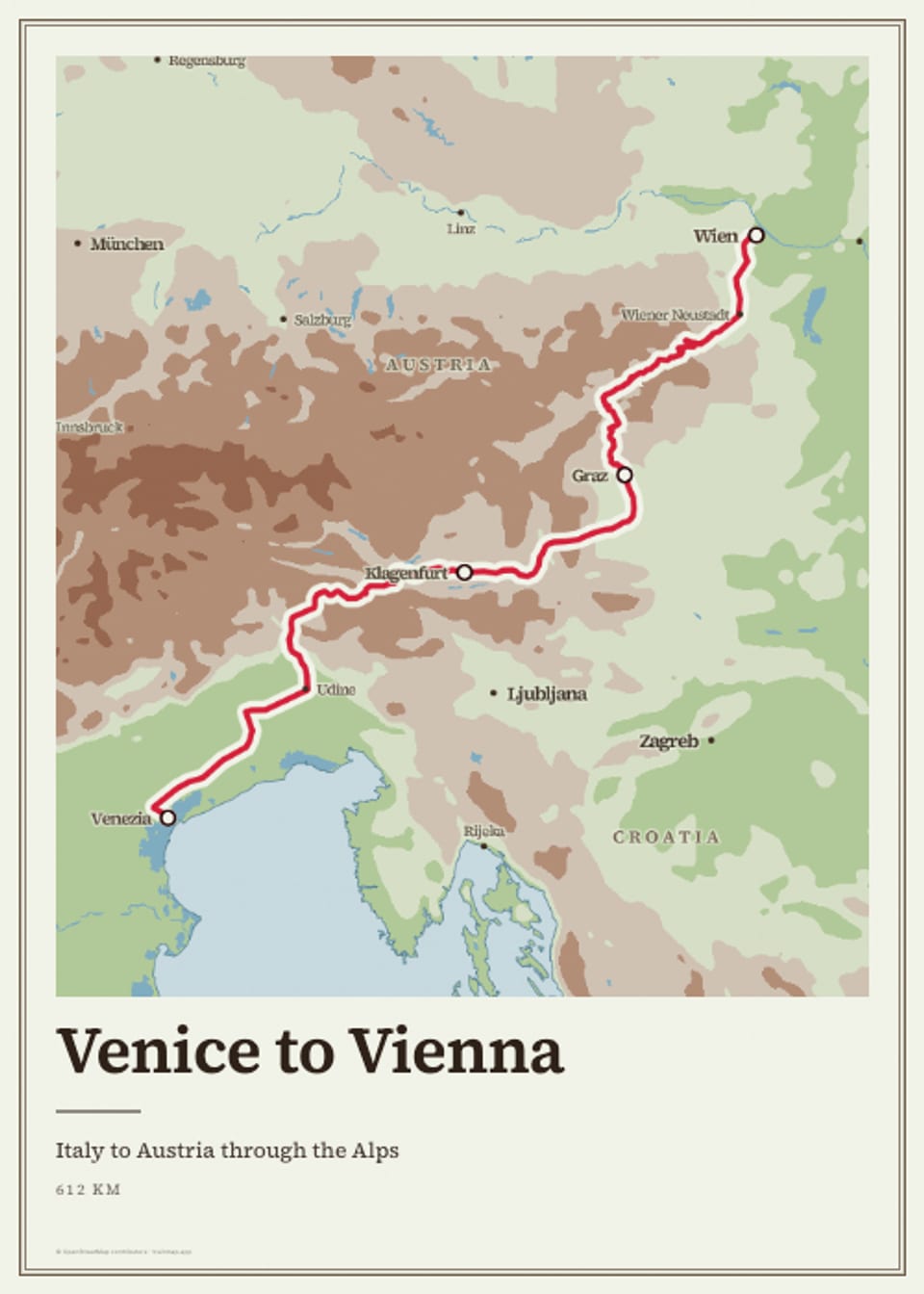
Venice to Vienna poster
image · 960×1344 · 5:7 · 0.1 MB
The Venice to Vienna as a 50 × 70 cm poster on the Atlas map: the line in claret, the title "Venice to Vienna", "Italy to Austria through the Alps" and the distance.
- Map styles
- Atlas
- Routes
- Venice to Vienna
- On screen
- Venice to Vienna
Italy to Austria through the Alps
625 km
- Alt text
- Poster of the Venice to Vienna on the Atlas map
- Link
- https://trainmap.app/routes/venice-to-vienna
- Captions
No caption drafted yet.
File · Metadata (JSON) · images/route-posters/venice-to-vienna/venice-to-vienna_poster_atlas_960x1344.jpg
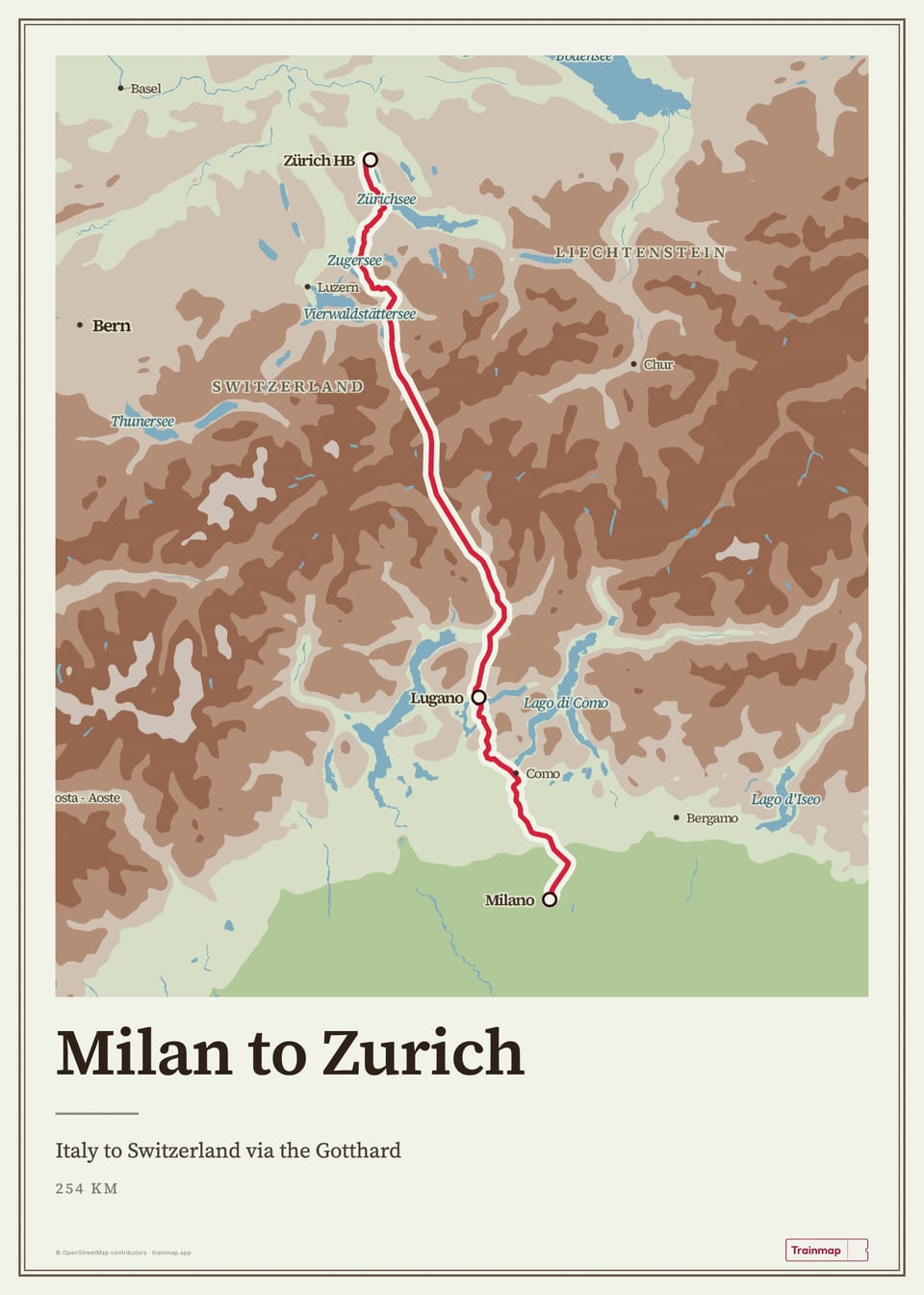
Milan to Zurich poster
image · 960×1345 · 5:7 · 0.1 MB
The Milan to Zurich as a 50 × 70 cm poster on the Atlas map: the line in claret, the title "Milan to Zurich", "Italy to Switzerland via the Gotthard" and the distance.
- Map styles
- Atlas
- Routes
- Milan to Zurich
- On screen
- Milan to Zurich
Italy to Switzerland via the Gotthard
254 km
- Alt text
- Poster of the Milan to Zurich on the Atlas map
- Link
- https://trainmap.app/routes/milan-to-zurich
- Captions
No caption drafted yet.
File · Metadata (JSON) · images/route-posters/milan-to-zurich/milan-to-zurich_poster_atlas_960x1345.jpg
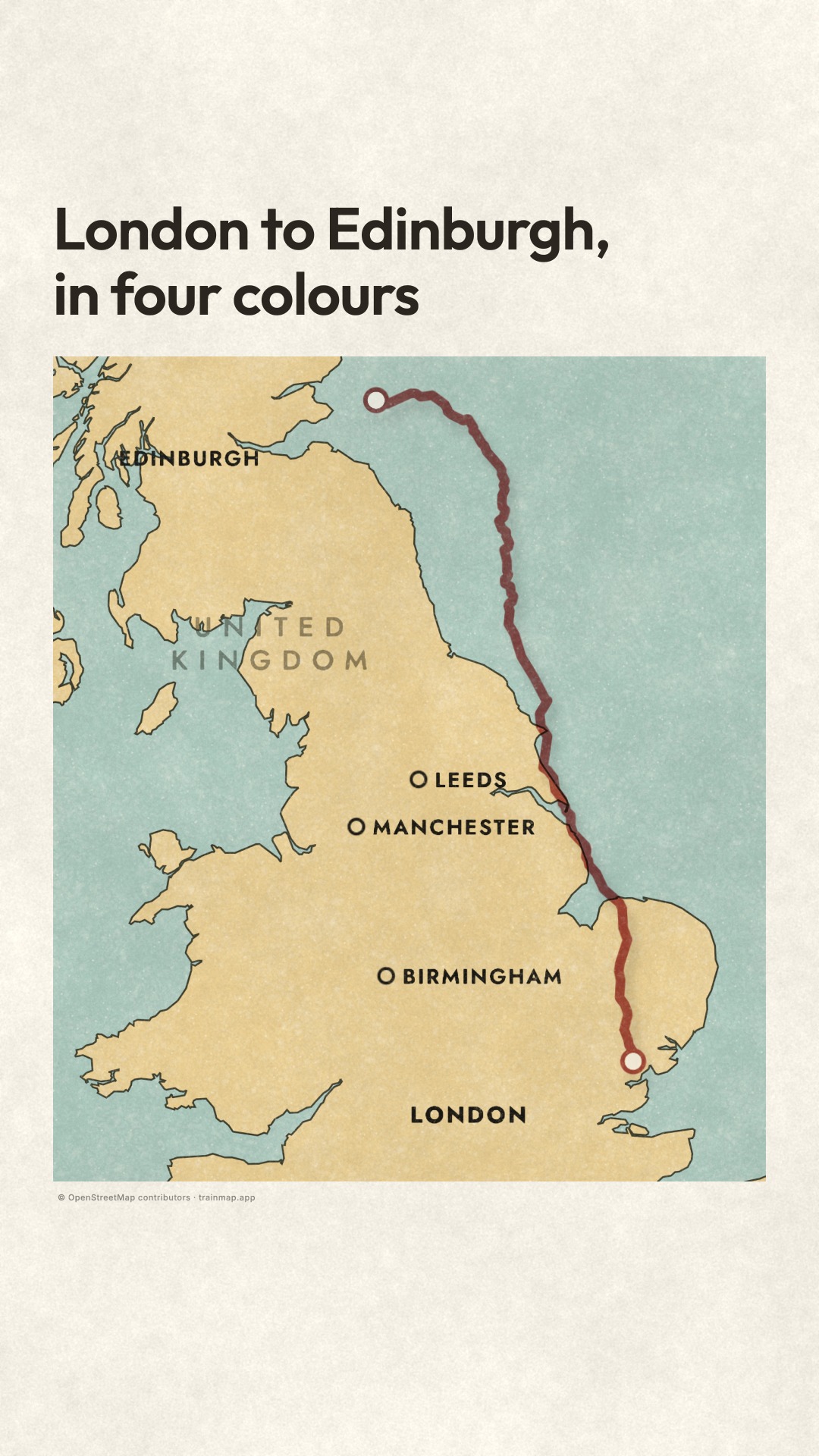
London to Edinburgh, in four colours: the map built from its layers (map version)
video · 1080×1920 · 9:16 · 18 s · sound · 7.5 MB
On a plain cream ground, the four colour layers of a London–Edinburgh map in the LMS 1925 look (water, land, the black names and coastline, then the red route) slide in out of register and lock into place one after another, each with a small jolt. The red route hangs out over the North Sea in near silence before it locks onto the tracks at 9 s. The four layers fan apart once and lock together again, then 'Draw a train trip, free / trainmap.app' appears.
- Map styles
- LMS 1925
- Routes
- London Kings Cross to Edinburgh Waverley (East Coast Main Line), drawn in the LMS 1925 look; distance not shown on screen
- On screen
- 0:00–~0:04.55 London to Edinburgh, / in four colours
throughout © OpenStreetMap contributors · trainmap.app
from ~0:05.4 map labels in the LMS 1925 look (place names such as LEEDS, MANCHESTER, BIRMINGHAM)
0:13.2–0:18.0 Draw a train trip, free
0:13.8–0:18.0 trainmap.app
- Captions
No caption drafted yet.
File · Cover · Metadata (JSON) · videos/off-the-press/off-the-press-map_1080x1920_18s.mp4
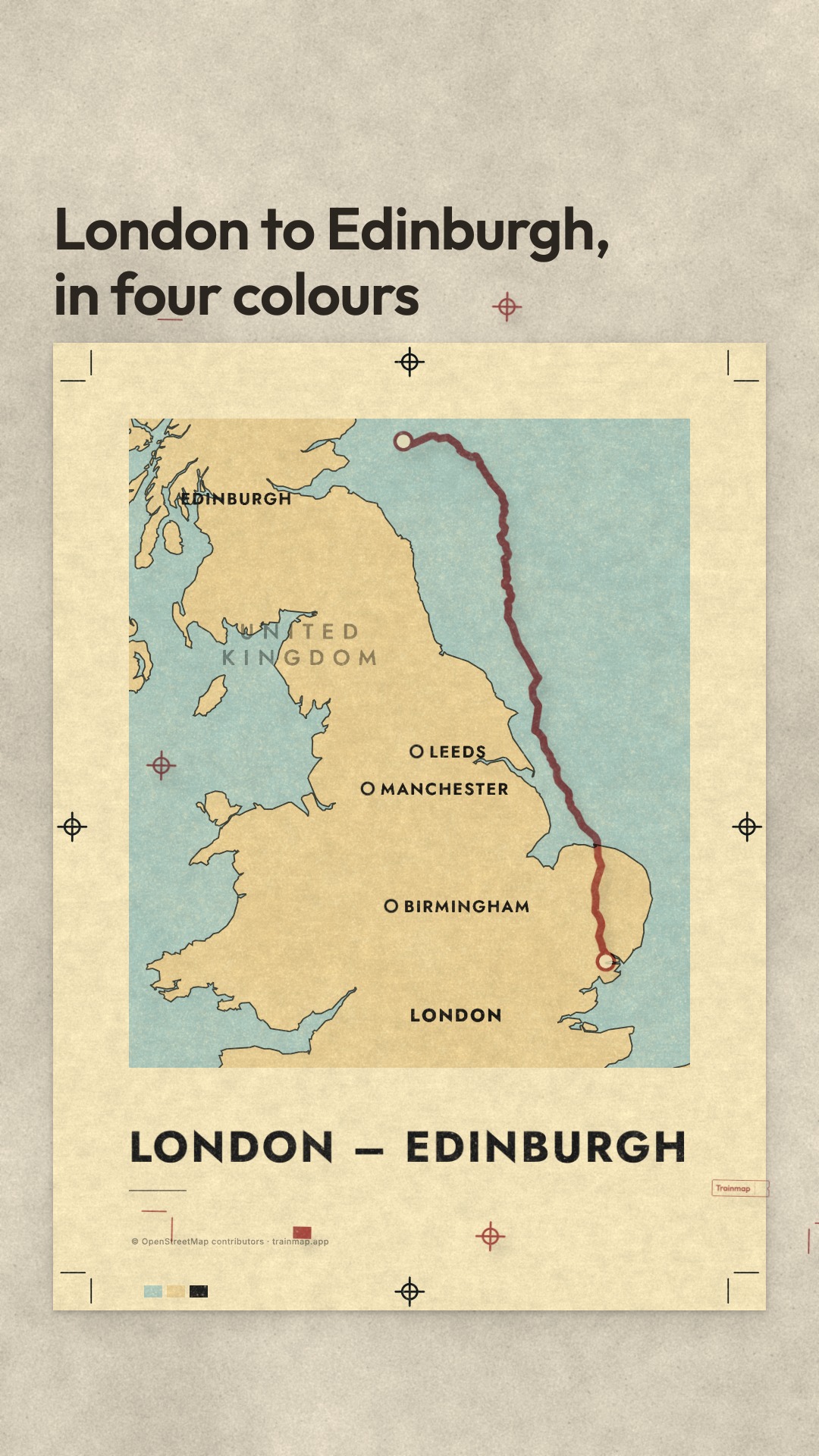
Off the press: a London–Edinburgh LMS 1925 poster printed plate by plate (poster version)
video · 1080×1920 · 9:16 · 18 s · sound · 7.5 MB
A blank sheet drops onto a litho stone, and four colour films (water, land, the black key with names and the poster title, then the red route) hover out of register and snap into place with a press thump. The red route plate hangs over the North Sea in near silence before it lands on the tracks at 9 s. The sheet is trimmed so the margin and its registration marks fall away, the poster lifts off the stone, and 'Draw a train trip and make it a poster / trainmap.app' appears.
- Map styles
- LMS 1925
- Routes
- London Kings Cross to Edinburgh Waverley (East Coast Main Line), drawn in the LMS 1925 look; distance not shown on screen
- On screen
- 0:00–~0:04.55 London to Edinburgh, / in four colours
0:05.4–0:18.0 LONDON – EDINBURGH
from 0:05.4 poster fine print: © OpenStreetMap contributors · trainmap.app, plus the ticket signature
0:13.2–0:18.0 Draw a train trip and / make it a poster
0:13.8–0:18.0 trainmap.app
- Captions
No caption drafted yet.
File · Cover · Metadata (JSON) · videos/off-the-press/off-the-press-poster_1080x1920_18s.mp4
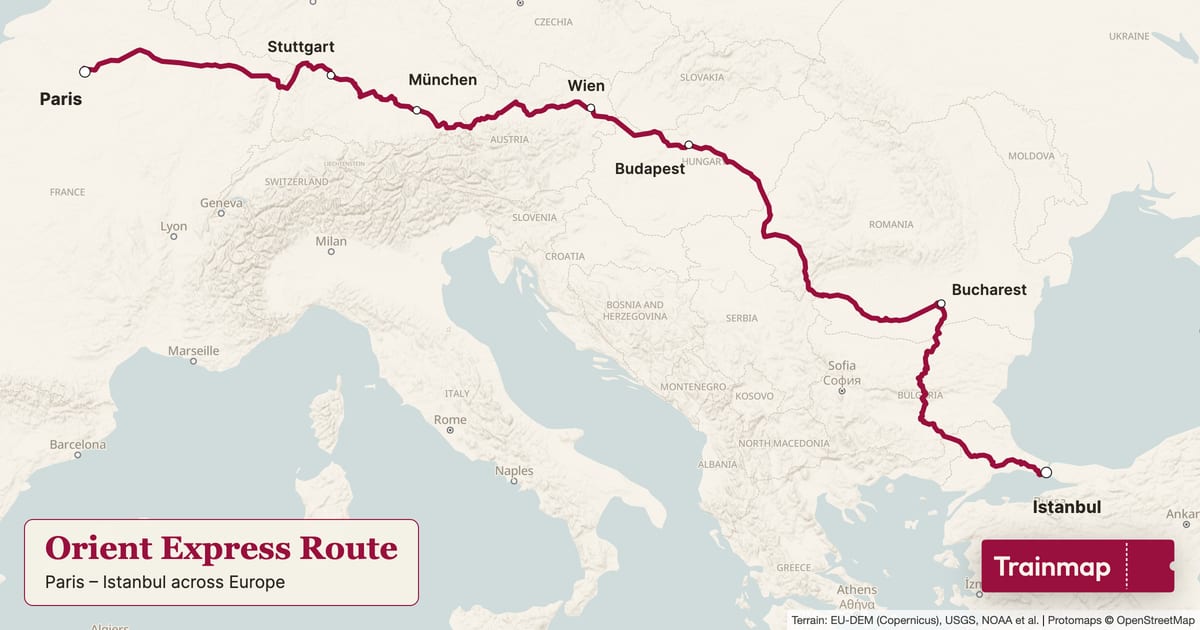
Orient Express route map
image · 1200×630 · 1.91:1 · 0.1 MB
The Orient Express line drawn in claret on trainmap.app's Clean map, stations marked, with a title panel ("Orient Express Route", Paris → Istanbul across Europe) and the Trainmap ticket.
- Map styles
- Clean
- Routes
- Orient Express
- On screen
- Orient Express Route
Paris – Istanbul across Europe
Trainmap
- Alt text
- Map of the Orient Express train route, Paris Gare de Lyon to Istanbul
- Link
- https://trainmap.app/routes/orient-express
- Captions
No caption drafted yet.
File · Metadata (JSON) · images/route-maps/orient-express/orient-express_map_clean_1200x630.jpg
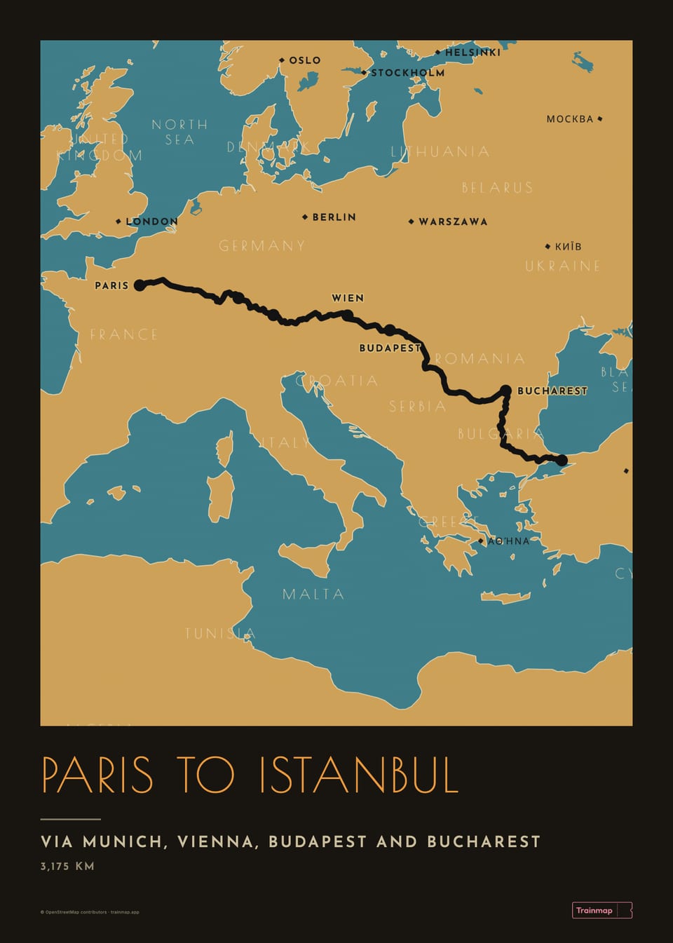
Orient Express poster
image · 960×1345 · 5:7 · 0.1 MB
The Orient Express as a 50 × 70 cm poster on the Rhein 1928 map: the line in claret, the title "Orient Express", "Paris → Istanbul across Europe" and the distance.
- Map styles
- Rhein 1928
- Routes
- Orient Express
- On screen
- Orient Express
Paris → Istanbul across Europe
3,175 km
- Alt text
- Poster of the Orient Express on the Rhein 1928 map
- Link
- https://trainmap.app/routes/orient-express
- Captions
No caption drafted yet.
File · Metadata (JSON) · images/route-posters/orient-express/orient-express_poster_rhein-1928_960x1345.jpg
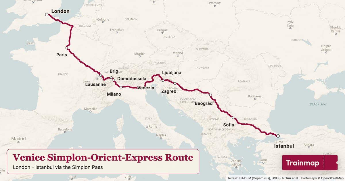
Venice Simplon-Orient-Express route map
image · 1200×630 · 1.91:1 · 0.1 MB
The Venice Simplon-Orient-Express line drawn in claret on trainmap.app's Clean map, stations marked, with a title panel ("Venice Simplon-Orient-Express Route", London → Istanbul via the Simplon Pass) and the Trainmap ticket.
- Map styles
- Clean
- Routes
- Venice Simplon-Orient-Express
- On screen
- Venice Simplon-Orient-Express Route
London – Istanbul via the Simplon Pass
Trainmap
- Alt text
- Map of the Venice Simplon-Orient-Express train route, London St Pancras International to Istanbul
- Link
- https://trainmap.app/routes/venice-simplon-orient-express
- Captions
No caption drafted yet.
File · Metadata (JSON) · images/route-maps/venice-simplon-orient-express/venice-simplon-orient-express_map_clean_1200x630.jpg
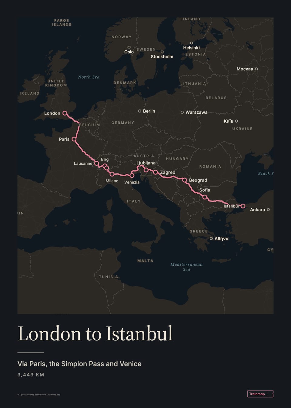
Venice Simplon-Orient-Express poster
image · 960×1345 · 5:7 · 0.1 MB
The Venice Simplon-Orient-Express as a 50 × 70 cm poster on the Dark map: the line in claret, the title "Venice Simplon-Orient-Express", "London → Istanbul via the Simplon Pass" and the distance.
- Map styles
- Dark
- Routes
- Venice Simplon-Orient-Express
- On screen
- Venice Simplon-Orient-Express
London → Istanbul via the Simplon Pass
3,443 km
- Alt text
- Poster of the Venice Simplon-Orient-Express on the Dark map
- Link
- https://trainmap.app/routes/venice-simplon-orient-express
- Captions
No caption drafted yet.
File · Metadata (JSON) · images/route-posters/venice-simplon-orient-express/venice-simplon-orient-express_poster_dark_960x1345.jpg